When setting up a homeschooling room or planning elementary social studies lessons, geography tools are a core requirement. For decades, the standard choice was a physical desktop globe. However, technology has introduced interactive alternatives.
If you are trying to choose between physical globes vs digital AR maps, this guide breaks down the benefits, costs, and practical aspects of each approach to help you make an informed decision for your children.
1. Physical Footprint and Storage
Storage space is a frequent challenge for parents and teachers.
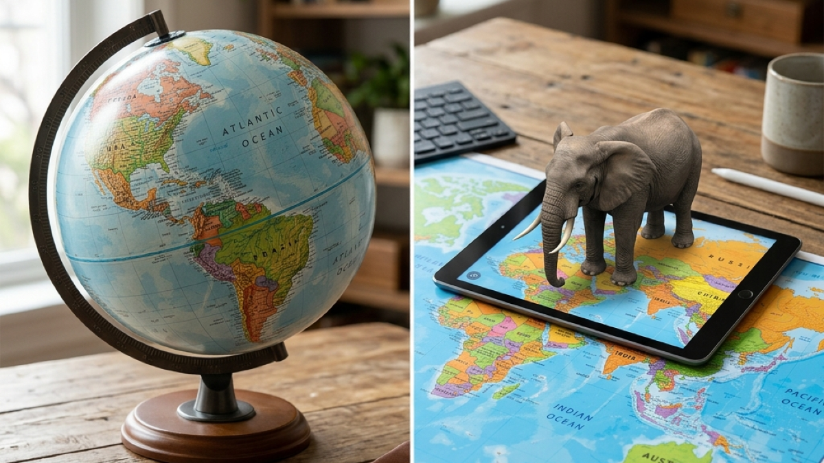
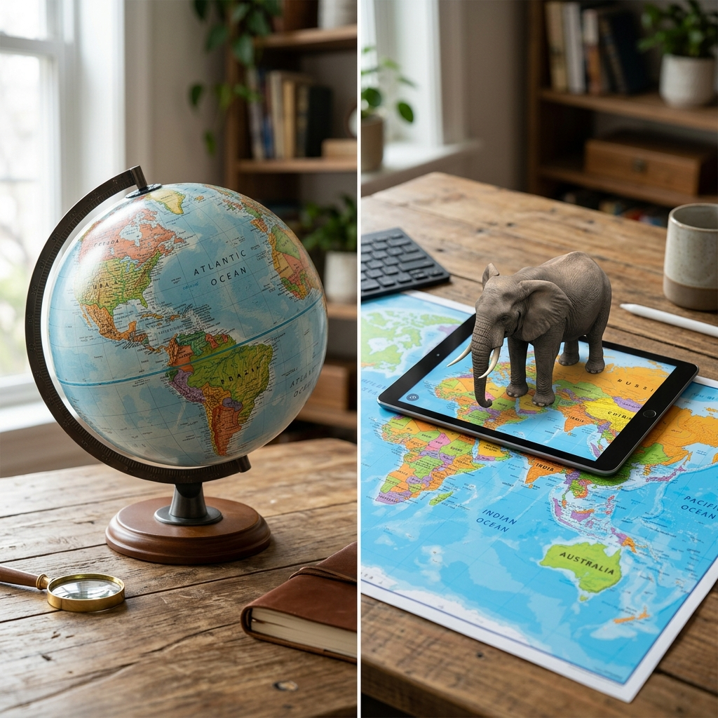
- Physical Globes: Traditional globes are bulky. A standard 12-inch globe requires a dedicated spot on a desk or shelf. Because they are round and fragile, they cannot be stacked or packed away in a thin drawer. They collect dust and are easily knocked over by active toddlers.
- Digital AR Maps: Digital-first maps, such as the printable map from Eduarise, have a zero-clutter footprint. You receive a high-resolution PDF file that you print on standard paper or poster board. When study time ends, you can roll the map up and slide it into a mailing tube, or fold it flat into a binder. If you have limited space, digital AR maps are the clear winner.
2. Interactive Learning and Dynamic Updates
Geopolitical borders change over time. Cities are renamed, new nations emerge, and geographical facts are updated.
- Physical Globes: Once a physical globe is manufactured, its borders are permanent. If you want updated country names or political borders, you must buy a brand new globe. Furthermore, a traditional globe is static—it cannot play audio, animate weather patterns, or show regional wildlife.
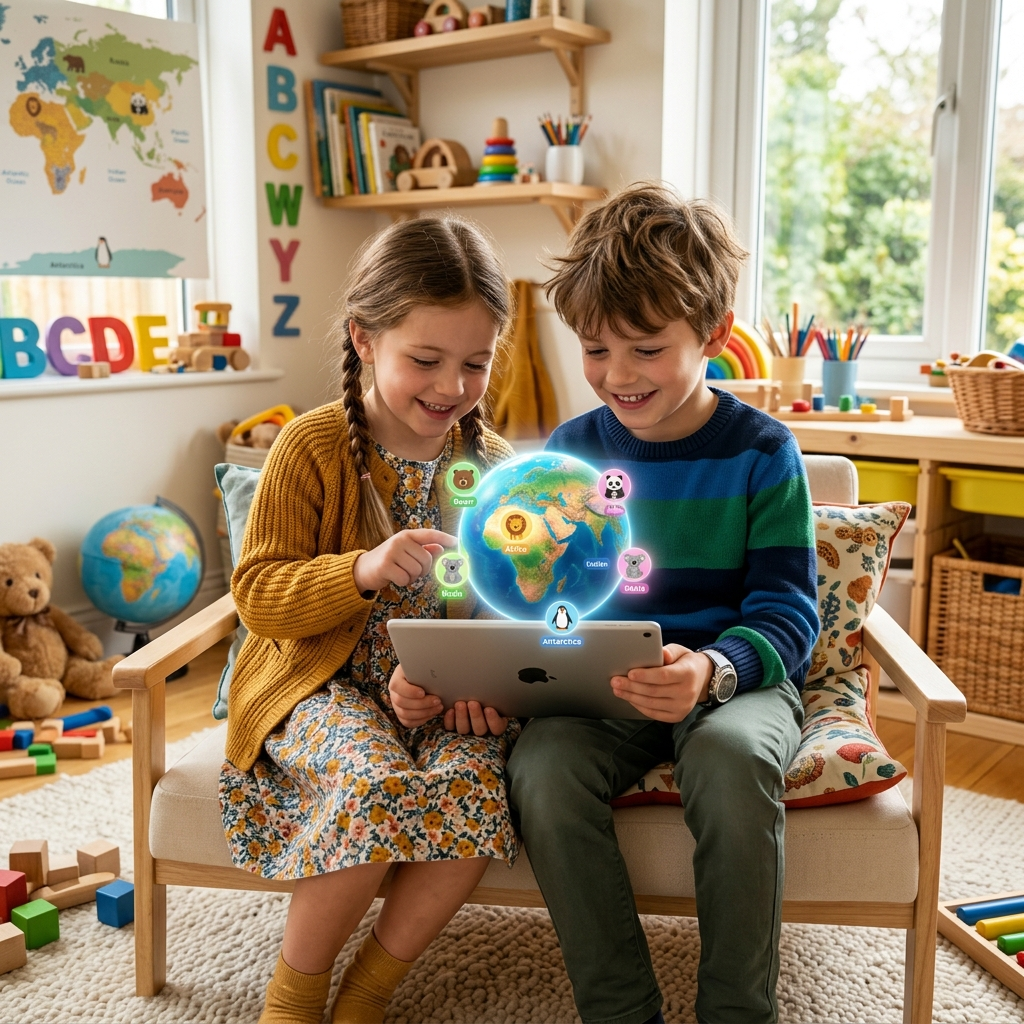
- Digital AR Maps: Digital AR maps use tablet apps to project virtual models onto the physical map. If borders change, the app creator updates the software, and your map remains accurate.
Additionally, the overlay is dynamic. Tapping on a continent displays 3D animal models, plays regional music, and opens interactive quizzes. It provides a level of engagement that static plastic spheres cannot match.
👉 Read about the technical advantages of this format in our detailed article: Why Printable AR Maps are the Future of Interactive Learning.
3. Spatial Cognition and Cognitive Development
How do these tools affect a child's understanding of the world?
A physical globe is a sphere, which represents the Earth’s shape without distortion. Flat maps distort the size of continents near the poles. Because of this, some educators argue that physical globes are necessary for early childhood development.
However, research shows that interactive digital maps bridge this gap. According to a study on spatial reasoning published in the National Institutes of Health (NIH) PMC Database, interactive 3D interfaces help kids develop strong spatial rotation skills.
When a child holds a tablet and walks around a flat AR map, the app renders a 3D globe on screen that rotates as the child moves. This active physical movement combined with screen interaction gives kids the spatial accuracy of a globe alongside the detail of a large flat map.
4. Tactile vs. Digital Interaction Modes
Children learn through multiple sensory channels. When comparing tools, think about how they interact with each device.
- Tactile Spherical Play: Spining a physical globe is satisfying. It helps children grasp the rotation of the Earth on its axis. However, this interaction is limited. Beyond spinning, there are no tactile feedback signals.
- Active AR Interaction: With a digital AR map, the tablet acts as a dynamic lens. To see details of a country, the child must move the tablet closer, physically zooming in. To see different angles of a mountain range or historical monument, they must walk around the table or rotate the printed map. This active physical participation engages both fine and gross motor skills, linking kinetic movement with visual learning.
5. Durability and Replacements
Elementary school classrooms and home playrooms are high-wear environments. Crayons, markers, and spilled juice are common hazards.
- Physical Globes: If a child draws on a physical globe or cracks the plastic meridian, the toy is permanently damaged. Replacing a premium physical globe is expensive.
- Digital AR Maps: If a child spills juice on a printed map, you do not need to buy anything new. Because you own the digital file, you can print a fresh copy on standard paper or heavy cardstock immediately.
For classrooms, this is a major benefit. A teacher can print a new copy of the map for every student at the start of the semester, allowing kids to write directly on the map, color it, and scan it with school tablets.
👉 For a look at how this compares to physical smart globes, see our direct comparison: PlayShifu Plugo vs. Eduarise: Comparing Interactive STEM Kits.
6. Cost and Value Comparison
Let's look at the financial investment required for both options.
FeatureTraditional Physical GlobesSmart Globes (e.g., Orboot)Digital AR Maps (Eduarise)Average Cost | $30 - $70 | $50 - $80 | $14.99 (Single download)
Interactive Content | None (Static text) | Rich 3D animations | Rich 3D animations & audio
Footprint | Bulky, sits on desk | Bulky, sits on desk | Rollable, folds flat
Replacement Cost | Full purchase price | Full purchase price | $0 (Reprint anytime)
Classroom Scaling | Expensive to buy multiple | High school budget impact | Unlimited prints per license
Scale & Customizability | Fixed size | Fixed size | Can print letter or poster size
As the matrix shows, traditional globes lack interactive features, and smart physical globes are expensive investments. The digital download model provides the rich interactivity of a smart globe at a fraction of the cost.
👉 See how the digital map stacks up against other popular smart globes: Eduarise vs. PlayShifu Orboot: Which AR Globe is Best?.
Which Tool is Right for Your Child?
To make your final decision, consider your specific learning environment:
Choose a Physical Globe if:
- You want a traditional decorative piece for a desk or library shelf.
- You prefer a static, screen-free learning environment and do not want to use a tablet or phone for geography study.
Choose a Digital AR Map if:
- You want to save money: At $14.99, it is the most affordable interactive map option available.
- You have limited space: You want a map that can be packed away in a drawer when not in use.
- You want durability: You want the peace of mind that comes with being able to print a new copy if the map is damaged.
- You have multiple kids: You want to print separate maps for each child so they can work together or individually without sharing a single globe.
- You want customizable scale: You want to print different sizes, from a small sheet for a binder to a massive poster for a classroom wall.
Conclusion: Geography Reimagined
Both tools have their place in a home. Traditional physical globes are beautiful classic tools. But for active, modern learning that fits a budget and saves storage space, digital AR maps offer unparalleled value.
Ready to start? Download the Eduarise AR World Map today and turn any desk into an interactive learning station!